
drone Services
We offer a range of services including drone mapping,
drone inspections, construction monitoring, asset verification, and more

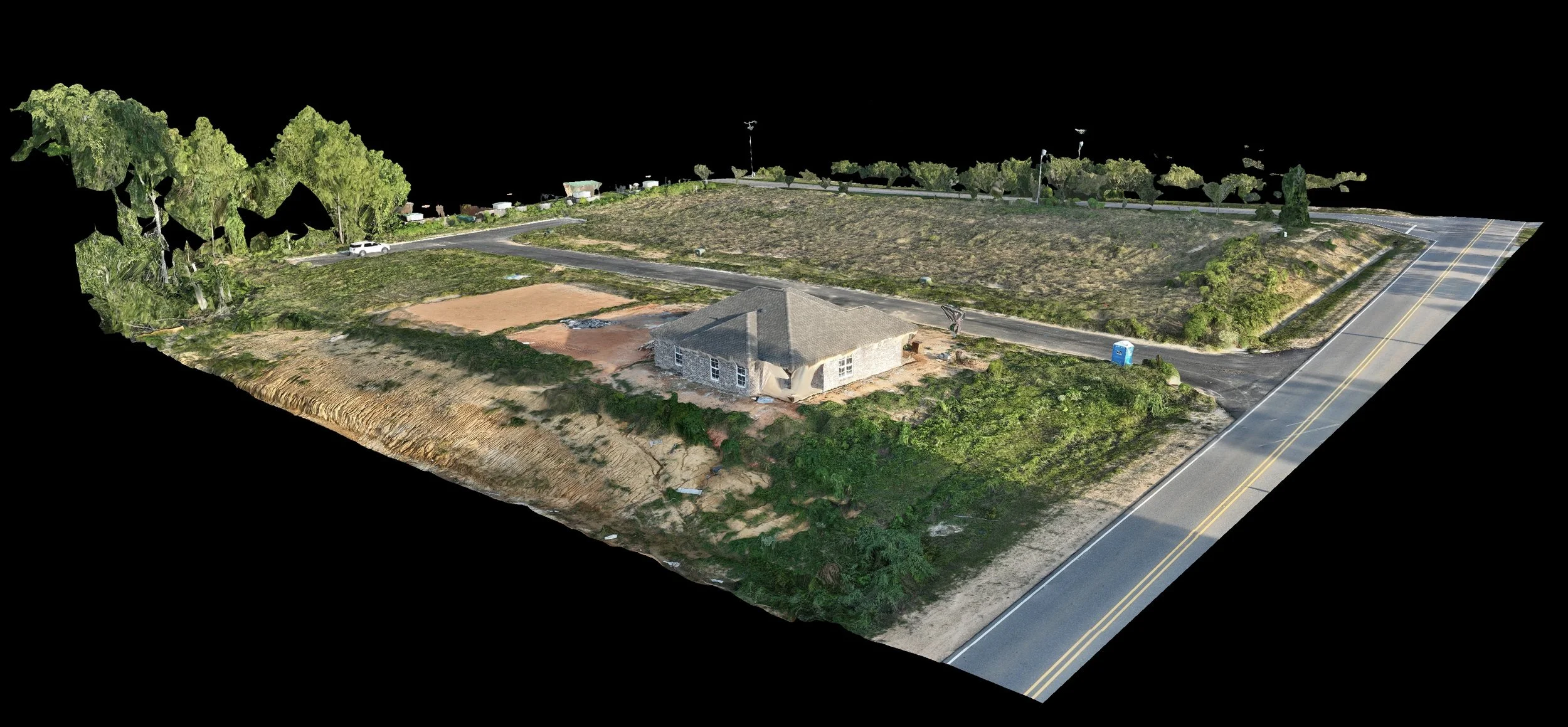
3D Modeling
3D models provide topographical information and visual representations of your site enabling better planning, monitoring, and communication throughout the construction project.
Commercial
Construction


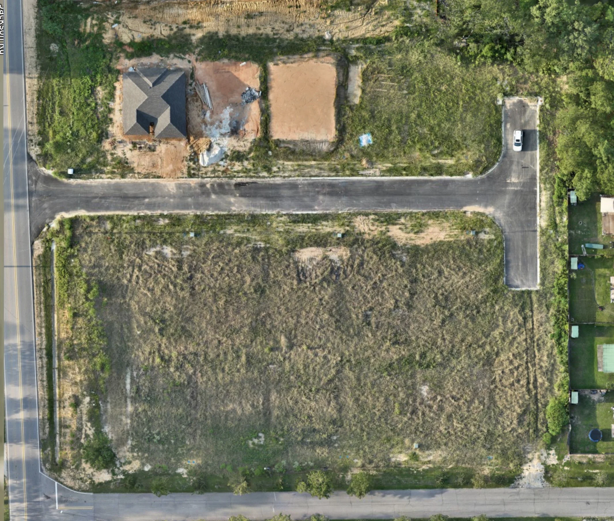
2d map


Sites
2D Mapping
2d mapping hepls construction teams plan and monitor the site, assess progress, identify potential issues, and make informed decisions throughout the construction project
Area Measurements
Accurately measure the area of different zones, structures, or land parcels within your site. this provides precise measurements that helps in planning and monitoring construction activities, enabling better resource allocation and facilitates decision-making based on accurate spatial data.
Annotations
Mark specific points, areas, or features on the map with text labels, symbols, or shapes. these annotations provide visual cues and notes for identifying and communication important information related to the construction site, such as landmarks, hazards, measurements, or project milestones.
Panoramas
360-degree views of your construction site provides a comprehensive and detailed visual representation of the site, allowing for in-depth inspection, analysis, and documentation of the surroundings.
residential construction sites

2d map with annotations
elevation
provides valuable information on the sites topography, slopes, and elevation changes. it helps with site planning, grading, drainage design, and earthwork calculations, ensuring efficient and informed decision-making during the construction project.
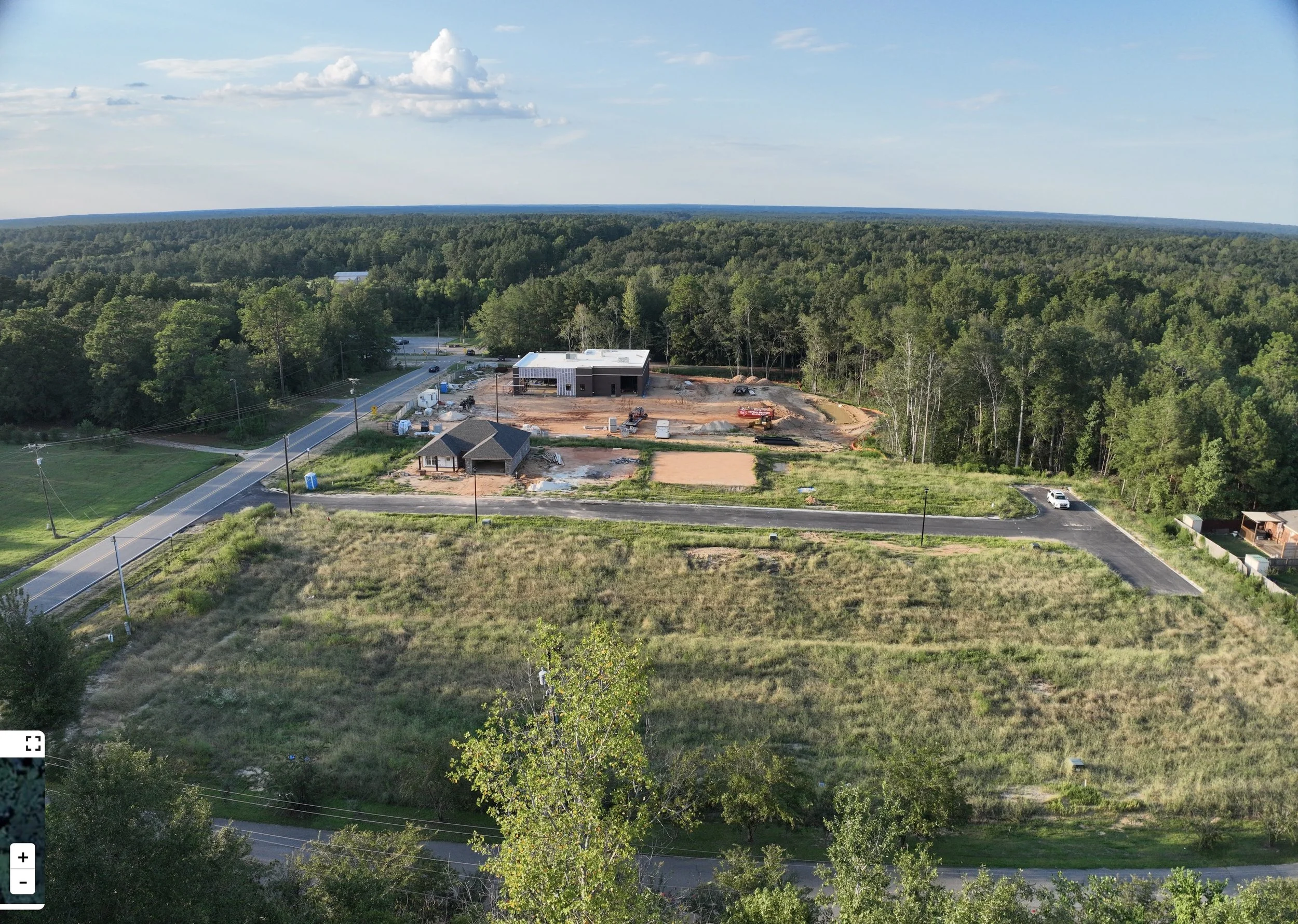
drone photos
drone photos provide detailed aerial imagery that captures the site’s progress, features, and conditions.

